
Airport digital maps & passenger flow tools
AirportCompass is the industry’s most advanced and flexible airport mapping platform


PRE-BUILT PASSENGER PRODUCTS
Contextualise the airport journey for passengers
Choose from our ready-to-use products and integrate them into your digital channels to craft your passenger journey

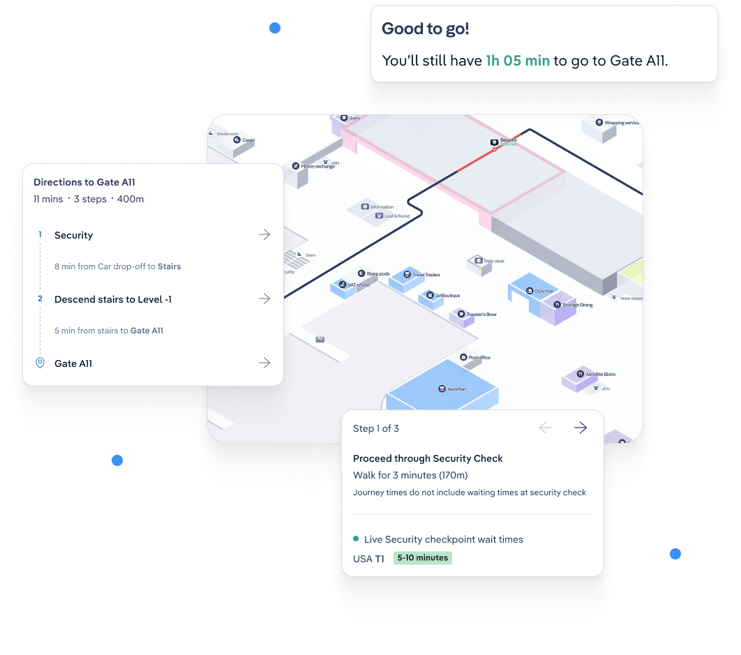
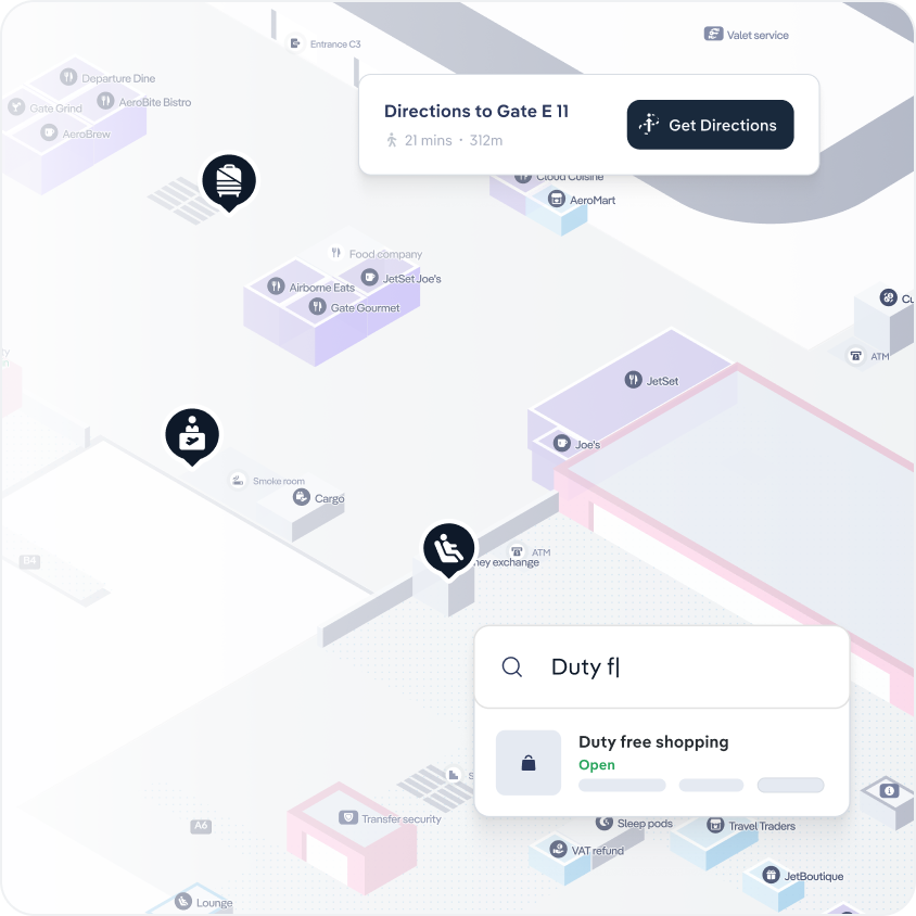
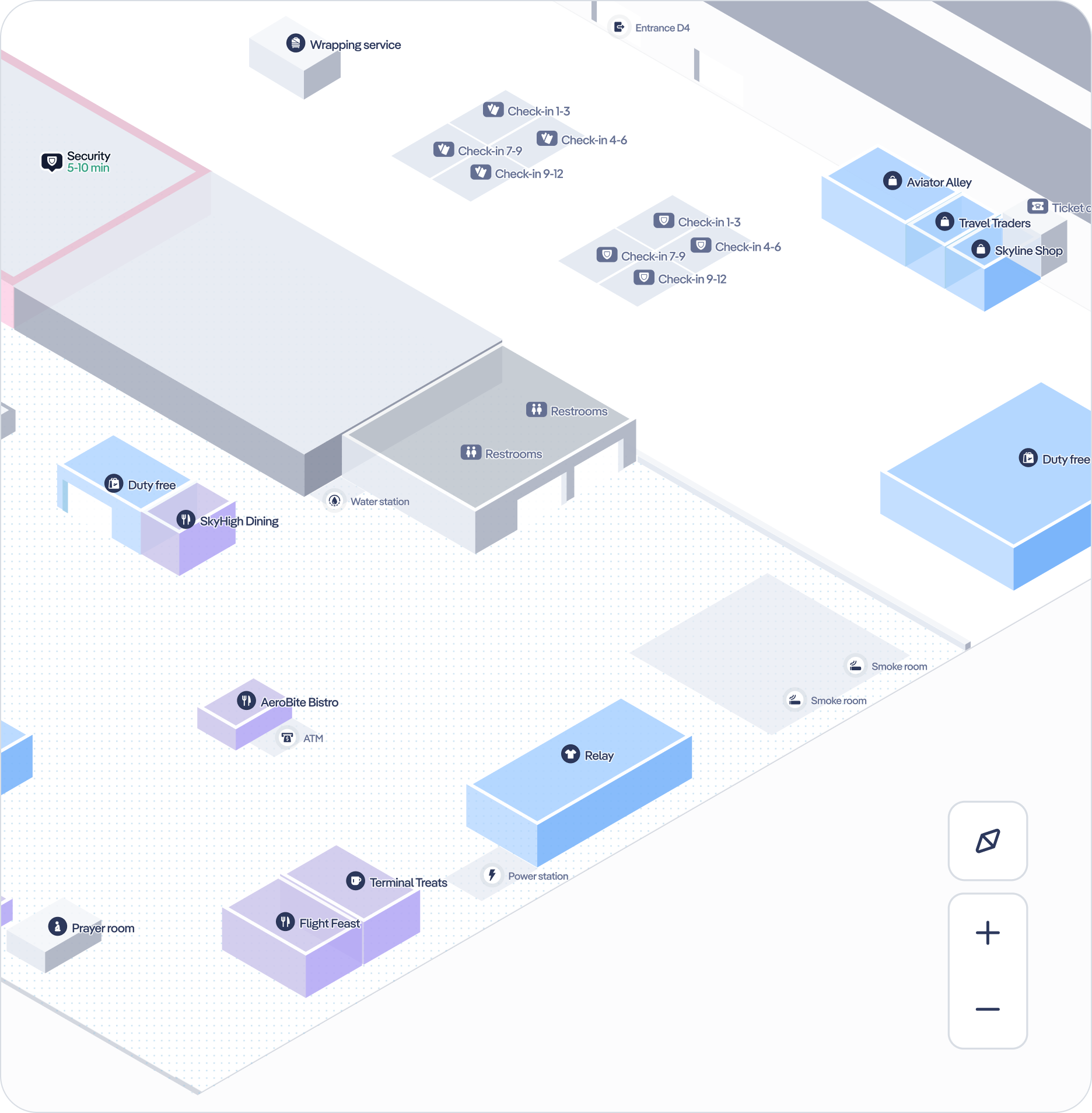
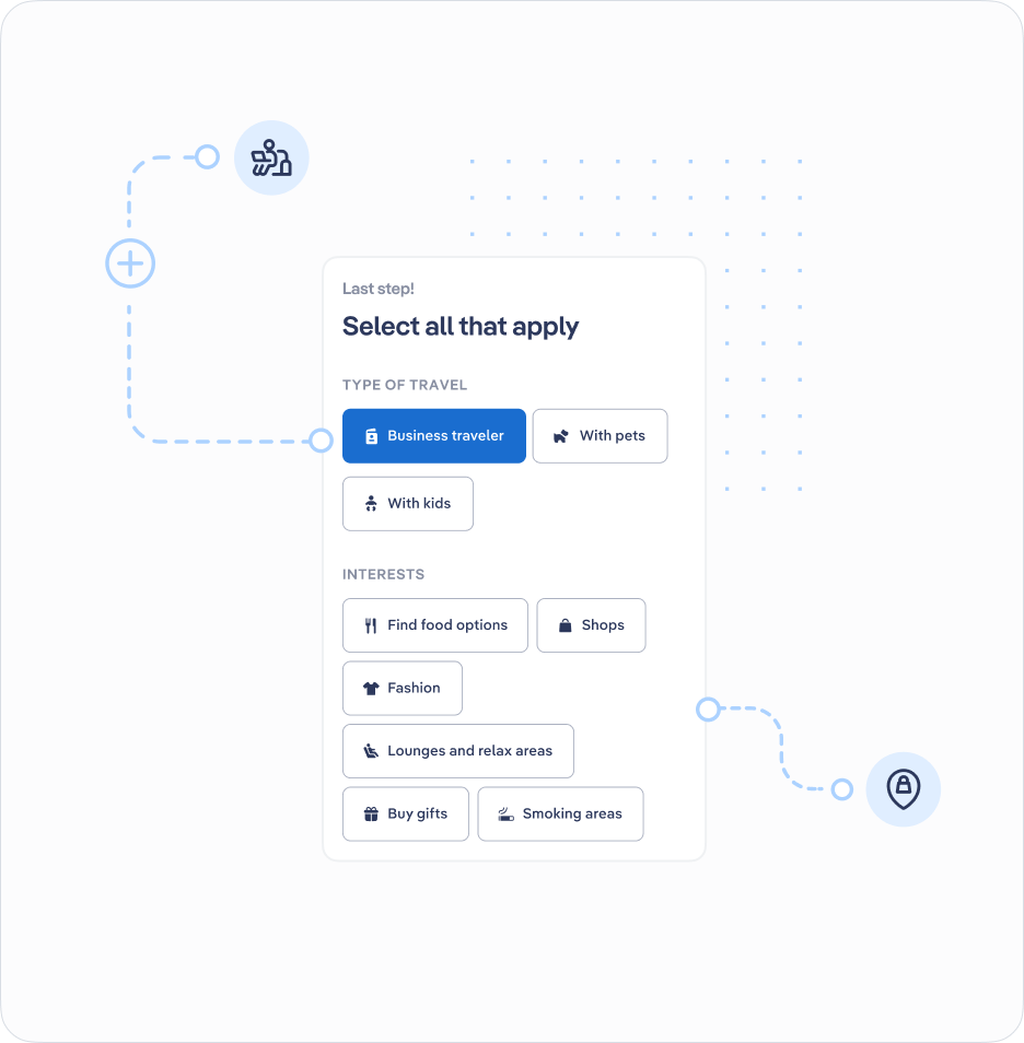
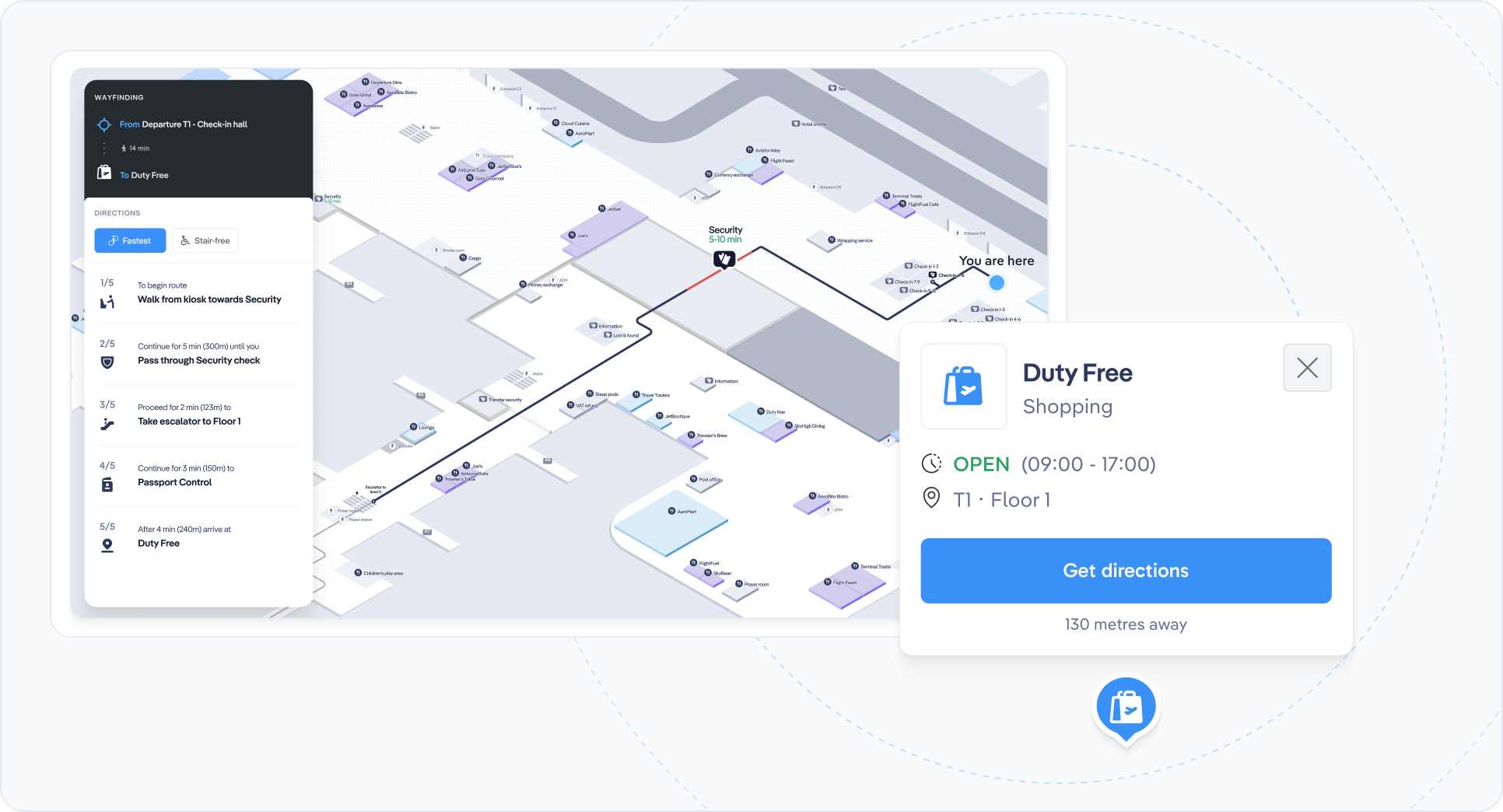
PaxMaps
Comprehensive 3D airport maps
Intuitive and interactive 3D airport maps with smart search, live airport flight, gate and queue time information, and navigation by POI or flight. Available as a standalone page, or a plug-in to your existing pages.

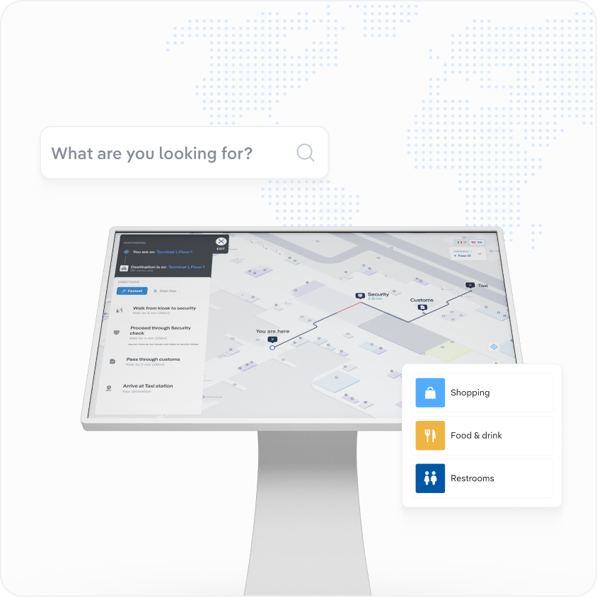
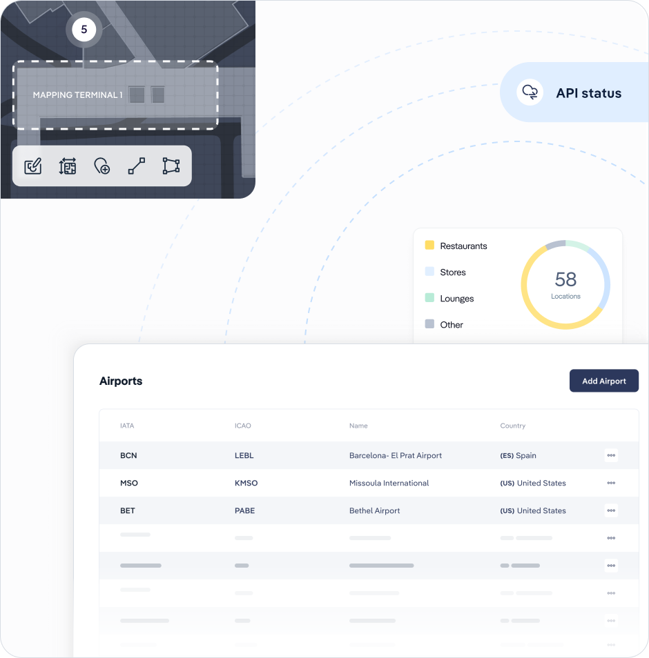
Kiosk
Touchscreen optimised passenger maps
Industry leading touchscreen-optimised maps, designed for kiosks and large airport touchscreens. Navigate users from specific kiosks to any POI or gate. Fully integrated with flight itineraries for gate assignments. Scan a QR code for mobile digital wayfinding.

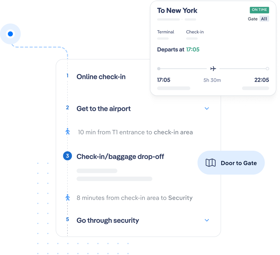
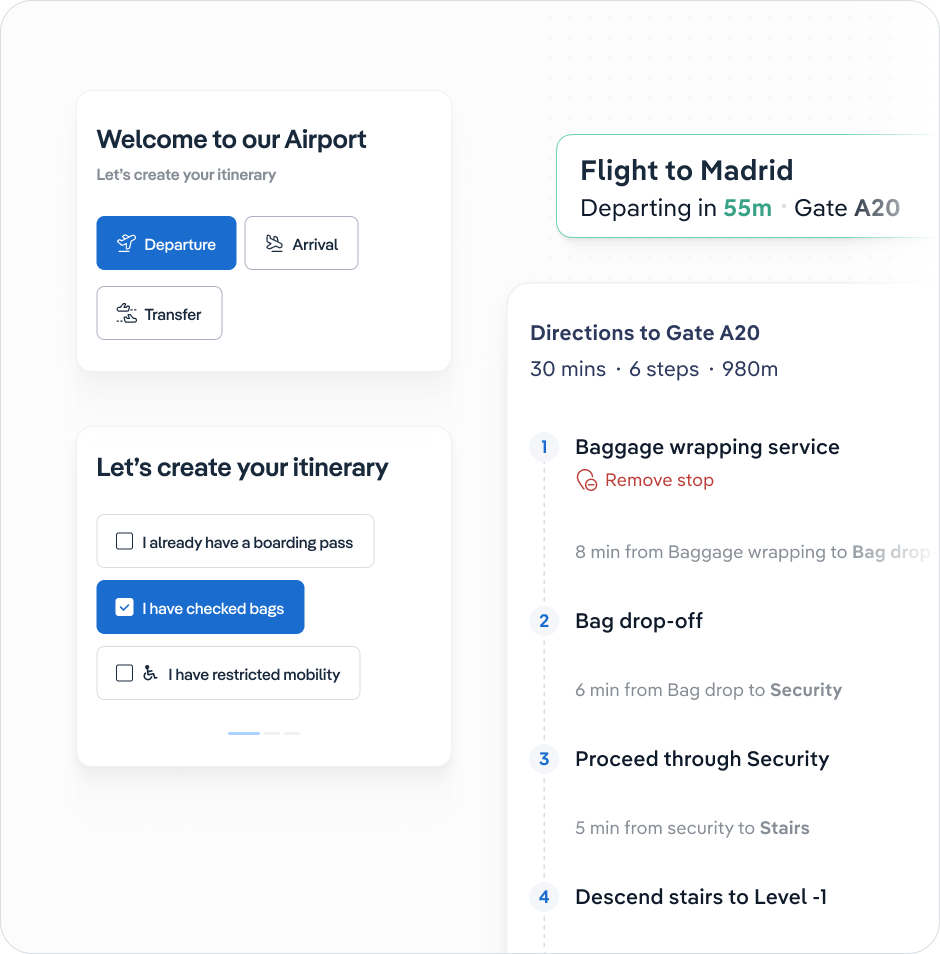
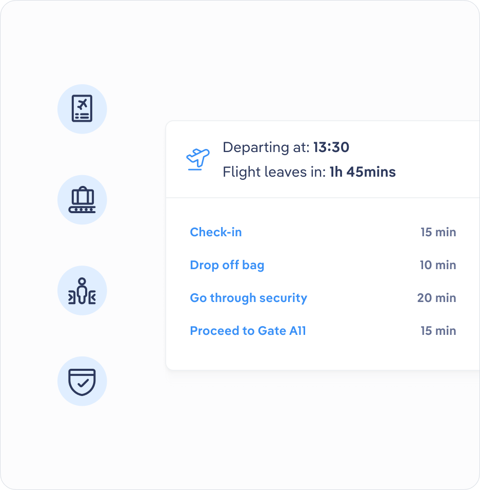
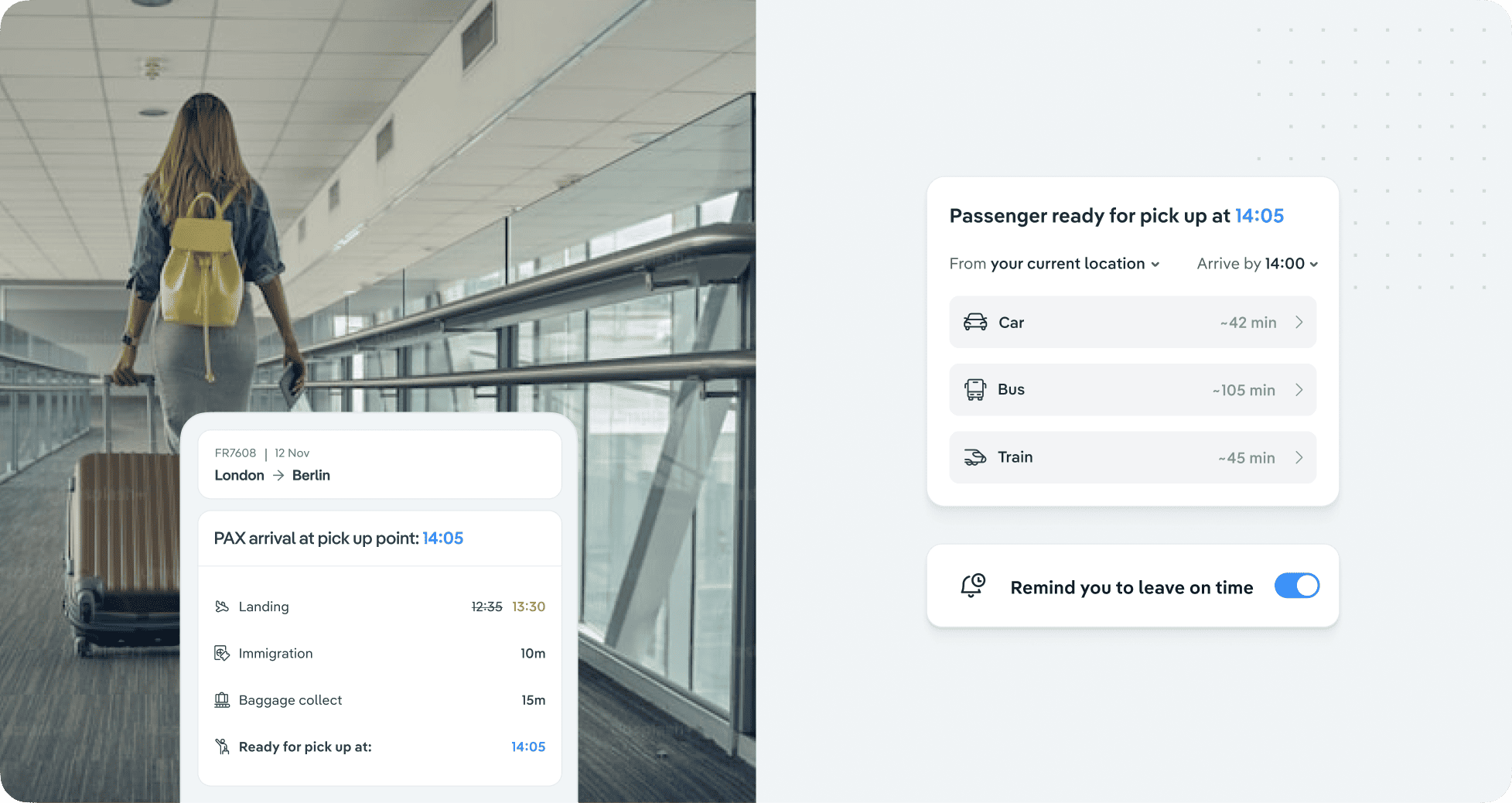
Journey Planner
Guide the passenger from home to flight
A door-to-gate journey planner that guides passengers from their home or hotel, through the airport, all the way to the gate of their flight. Wait times, gate information, and all required checkpoints included.

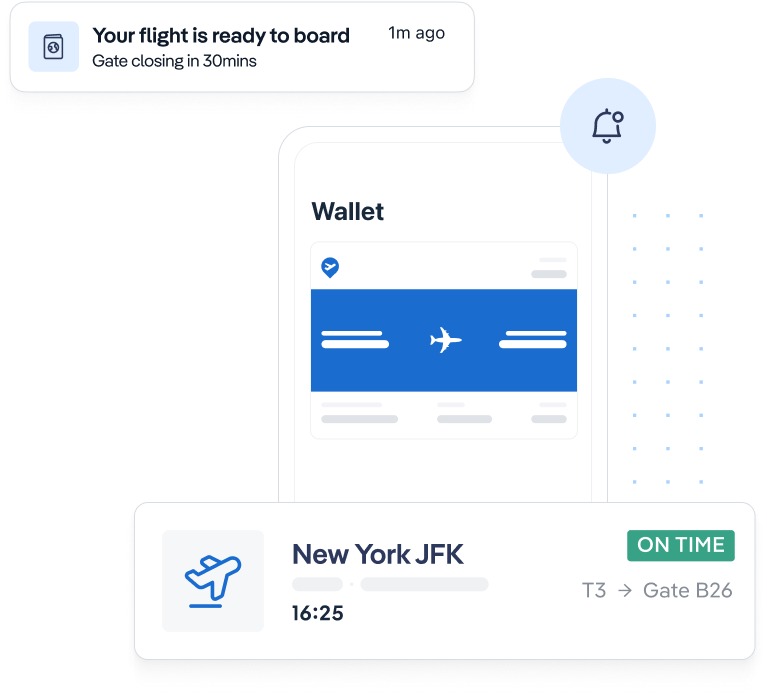
Wallet FIDS
Notifications and real-time flight updates
Provide real-time flight updates, including gate info, delays, and cancellations, synced directly with live airport data. WalletFIDS is compatible with Apple and Google Wallets so no app download is required.
![]()
Rome Fiumicino Airport
“Such a competent, reliable team with cutting edge technology that holds the potential of disrupting the way we see indoor location and wayfinding for large venues such as airports.”
Giulio Ranucci
Head of Innovation & Digital at A.D.R.
![]()
Copenhagen Airports CPH
“Copenhagen Airport chose Airsiders out of 14 vendors due to the features and flexibility of the platform, which we found to be unmatched. The product won it, and the team lifted it way beyond our initial requirements, offering us a strategic partnership while spearheading cutting edge technology and wayfinding innovation. Most impressive company I’ve worked with for years.”
Johnathan Vincentz
Senior Business Developer
Beyond just passenger experience: explore how spatial technologies empower airport & airline operations teams to improve efficiency
SELF-SERVE
Increase self-serve usage
Discover how you can reduce the number of queries received by your infodesk agents
CURB-SIDE CONGESTION
Reduce curb-side congestion
Learn how you can improve curb side operations by providing data on expected arrival times
MISCONNECTION PREDICTION
Reduce impact of delays on OTP
Find out how maps empower OCCs to make time-critical decisions for connecting PAX

Reaching & empowering passengers pre-travel
Uncover insights from various airport leaders in our free eBook!
Get eBook
Get in touch with our team for
a personalised demo